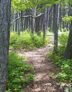
There are many quality hiking very close to Montana’s Flathead Lake. The views from these hikes around Flathead Lake are both beautiful and vast. Hiking is a great way to explore the area while experiencing nature and wildlife. We have created a list of trails you may enjoy. The list of trails when hiking Flathead Lake can be found below.
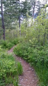
Each trail offers an adventure into the vast openness of untouched country and environment.
First things first, when hiking around Flathead lake you should be sure to carry bear spray. Be sure to carry it with your finger in the hole, and your thumb on the safety. Really, be safe, carry bear spray. With that said there are ample hiking opportunities around Flathead Lake.
Get your 150+ page Flathead Lake trail guide. or visit the website: GoHikeWithMike.com
Hiking Trail: Crane Mountain Trail #314
Of the three trails on this page, this trail is best if you are looking for aerial views of Flathead Lake. The Crane Mountain trail is 2.1 miles long (total of 3.5 miles from trailhead) and climbs about 330 feet. It begins at the junction with the Beardance Trail #76 and ends at the junction with Road #10218 near Crane Mtn Rd. From the Beardance trailhead this is one of three trails that climb up Crane Mountain. This lesser known trail starts winding up a few switchbacks through a larch/pine forest with thick undergrowth. It then straightens out and parallels Crane Creek to an old road bed. Turning left, follow the level road out to the upper trailhead. The trail is open for the following uses: hiking, horseback riding, and mountain biking.
From Bigfork, go south on Highway 35 past Woods Bay and turn right after mile marker 23, entering the Beardance trail head parking. The trailhead is on the east side of the highway.
Hiking Trail: Noisy Creek Trail #8
The Noisy Creek trail is 1.9 miles long and climbs 850 feet. It begins at the end of Jewel Basin Road #5392 and ends at the junction with Alpine Trail #7. This is one of many accesses to the Jewel Basin Hiking Area. The trail is open primarily for the following uses: Hiking. Other uses are allowed, but not recommended, up to the Hiking Area boundary.
From Bigfork, go north on Highway 35 for 2.3 miles and turn right onto Hwy 83. Stay on Hwy. 83 for 2.8 miles and turn left onto Echo Lake Road. After 2.2 miles, turn slightly right onto the Foothills Road. After 1.1 miles, turn right onto Rd. # 5392, following the Jewel Basin Road signs. The trailhead is 6.6 miles at the end of the road. Trail #8 starts at parking lot see information boards to make sure you are starting on the right trail as there are several that leave the parking lot.
It doesn’t matter if you are a novice hiker or you love a challenge: Jewel Basin has a hike for you. You’ll discover 15,349 acres of wilderness, 27 lakes and nearly 50 miles of hike-only trails.
The Jewel Basin is located just outside of Bigfork in the Flathead National Forest. To access the trailhead from Bigfork, take Hwy 35 north to Hwy 83. Head east on Hwy 83 to the junction of the Echo Lake Road. Head north on Echo Lake Road about 3 miles to junction with the Jewel Basin Road (No. 5392). Follow this road approx. 7 miles to the trailhead.
Hiking Trail: Crater Notch Trail #187
The Crater Notch Trail is 3.7 miles long and climbs about 3,000 feet. It begins 1/2 mile up the Echo-Brokenleg Trail #544 and ends at the Alpine Trail #7 leading to In-thlam-keh Lake. The trail is open for the following uses for the first 2.7 miles: hiking, horseback riding, and mountain biking. After 3.5 miles the trail enters the Jewel Basin Hiking Area where the only allowed use is hiking. Please respect these guidelines.
From Bigfork, go north on Highway 35 for 2.3 miles and turn right onto Hwy. 83. Stay on 83 for 2.8 miles, turning left onto Echo Lake Rd. After 2.2 miles, merge slightly right onto the Foothills Road. After 1.1 miles turn right onto Road #5392 also called Jewel Basin Rd. The trailhead is about two miles up the road on the right.
FLATHEAD LAKE TRAIL GUIDE
 The Go Hike with Mike trail guide contains most every trail head in the Flathead and Kootenai Forest as well as the Mission Mountain Tribal Wilderness. Click here to purchase your copy.

 The Mission Mountains Tribal Wilderness is located on the western slopes of the Mission Range. The area covers approximately 91,778 acres. It is roughly 34 miles long and five miles wide. Elevations range from four thousand to nearly ten thousand feet.
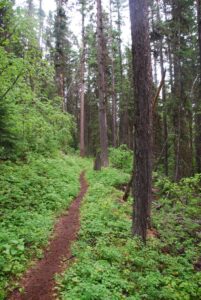 The Mission Mountains Tribal Wilderness is located on the western slopes of the Mission Range. The area covers approximately 91,778 acres. It is roughly 34 miles long and five miles wide. Elevations range from four thousand to nearly ten thousand feet.


 There are many quality hiking very close to Montana’s Flathead Lake. The views from these hikes around Flathead Lake are both beautiful and vast. Hiking is a great way to explore the area while experiencing nature and wildlife. We have created a list of trails you may enjoy. The list of trails when hiking Flathead Lake can be found below.

 The Go Hike with Mike Trail Guide contains most every trail head around Flathead Lake. The guide includes trails as far north as Polebridge.
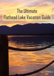
 Visiting Montana. We provide information and content for folks who are visiting Montana. Thank you for visiting our site. Many years back the Flathead Lake Vacation Guide was written to provide tourist with the information they needed while visiting Montana.
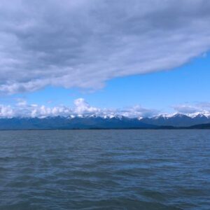 Flathead Lake is the largest natural freshwater lake in the western United States. Lying in the Flathead Valley of Northwest Montana, the lake is more then 300 feet deep and extends north and south some 28 miles and is seven to 15 miles wide.
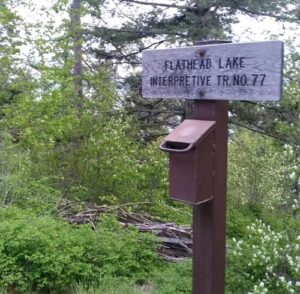 You can avail yourself of a boat tour or rent one of the many types of watercraft including canoes, kayaks, windsurfers, hydro bikes, sailing and fishing boats. Serious anglers can arm themselves with heavy-duty equipment and probe the 300-foot deep